
The fires, unfortunately, is an event that does not lead to expenses when it comes to devastating all the land that it catches in its path. They tend to manifest more in summer due to high temperatures, but you have to be vigilant throughout the year, so prevention is essential. For this, we have mobile phones as an indispensable tool for this task, with fire apps on Android.
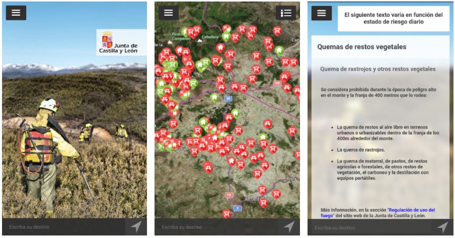
Castilla y León fires
Information system on the danger of forest fires, the regulation of fire use and the preventive measures established for each day in Castilla y León. This project aims to give citizens updated daily information in Castilla y León about the activities that are prohibited and allowed depending on the time of fire danger (burning of remains, use of machinery, use of barbecues, etc.)


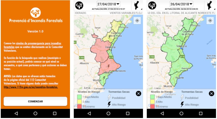
Pre-emergency IF Comunitat Valenciana
Know the pre-emergency levels for forest fires that are emitted daily in the Valencian Community. Depending on the search you carry out, whether it is a municipality or its current position, you will be able to know at what level it is, what area it belongs to and what actions should be taken. The data offered is taken from the official 112 website.

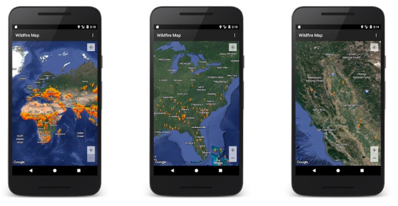
Wildfire map
It is an application created by the Finnish company Animated Oak Entertainment that allows to visualize the fires of the last 24-48 hours that are registered on the planet thanks to the satellites NASA Terra and Aqua and that are identified by points. It does not offer specific information on fires and should under no circumstances be used as an emergency warning tool.

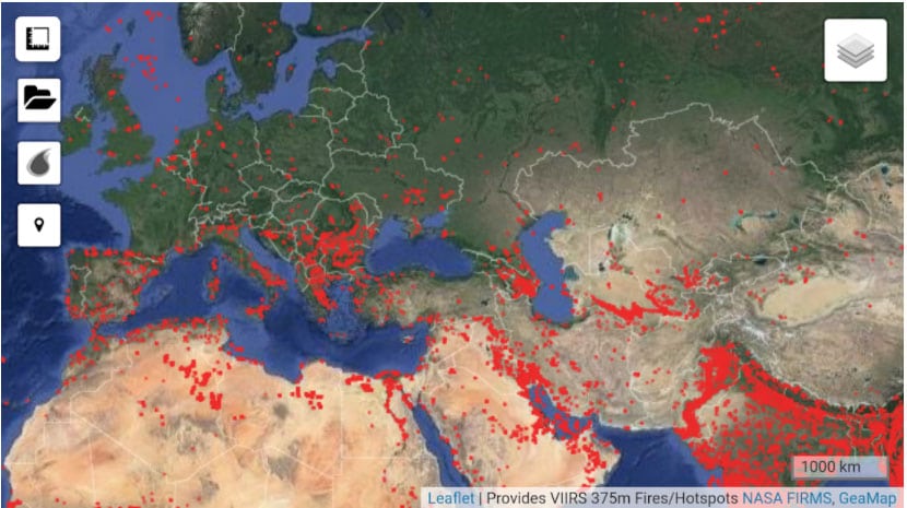
fire map
It is a fire map, in which all the existing fire sources in the world are shown in real time in real time. This is possible since the app shows the data collected by the Terra satellite and that NASA disseminates with real-time information of the fires. This satellite has MODIS and VIRIS sensors, which can recognize the infrared radiation emitted by any fire.

AFIS Wildfire Map
The key to this application is that notifications of new fires are created in real time thanks to the satellite measurements that detects these fires in different parts of the world. For this reason, the list of active fires is continually updated, to always have access to the most up-to-date information possible.

Wildfire Analyst Pocket
It is one of the fire apps that serves as a mobile forest fire calculator and that allows the forest fire community to analyze fire behavior with operational tools for use in the field. Sample maps of the territories and statistical elements with relevant parameters to help in that better understanding of fire.


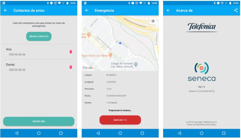
My112
If we are caught in the flames or we know someone who is in that situation, it is an app developed by Telefónica Soluciones and that allows contact the Emergency Center 112 automatically sending our location in the same call, to allow an instant location to the emergency services.

AlertCops
AlertCops is the official app of the State Security Forces and Bodies to maintain a two-way and instantaneous communication channel with the Police or Emergency Services. It is a complete application with the basic tools to report any dangerous situation, accessible to nationals and foreigners.

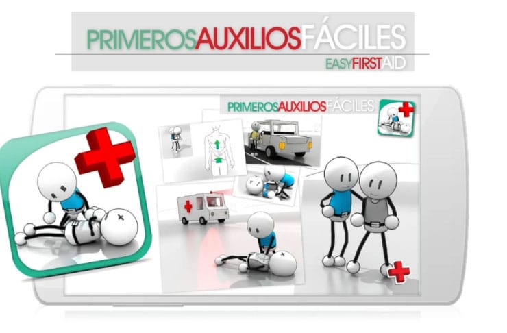
First Aid
Knowledge of first aid is not very widespread in our country, and yet it can mean the difference between life and death on occasions when health services are delayed. This application, with a Spanish seal, is aimed at learning and support in the occasions in which we have to use it.

Foc Control: Forest Fire Prevention
It is one of the fire apps designed for users who request agricultural-type burning authorizations, notifying burning activity in real time. Through the application, users will be able to check the times and dates allowed for carrying out burns in the towns where authorization has been requested.
