
The myth that the mobile phone promotes a sedentary lifestyle and little physical activity is often around due to its ability to overshadow time for users. We are going to show the opposite, and that it can be a very useful tool for exercising and being in contact with nature. Obviously this would not be possible without an application involved, since the terminal alone would not serve us, so we have chosen Wikiloc.


Especially if it is to do exercise related to cycling or hiking. And if we talk about the best free hiking apps, we have to mention yes or yes to Wikiloc . Sometimes we do not imagine all the functionalities and interesting things that can be achieved with this excellent app, also useful for other outdoor sports.
Created in 2006 in Spain by Jordi L. ramot. Same year that Google Maps Spain awarded this application for the best mashup. In 2008 he reached an agreement with Google to show the routes as a default layer in Google Earth.
What is Wikiloc?
Halfway between a maps app, a section with recommended routes and a social network of hikers, Wikiloc is a platform to which users upload the routes that they have made, including maps, photos, descriptions and all kinds of details about various types of routes.
In essence, it can be said that Wikiloc for Android is a whole community of people from many parts of the world who share their favorite routes and points of interest in different places in a country or region. The routes are recorded and shared with the Global Positioning System, that is, with the GPS.
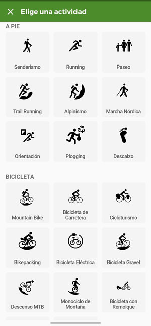
We can find millions of routes, many of them used for hiking, but which can also be useful for other outdoor sports such as cycling, climbing or skating. There are many good applications for hiking, Wikiloc for example, offers us different very useful functions, thus being a personalized application that adapts to our needs and tastes.

Wikiloc allows you organize your bike trips, discover new running itineraries by natural environments, go hiking with the family on a relaxed summer excursion or take nature routes in the most exotic and varied means of transport: kayak, 4 × 4, motorbike, snowshoes, horseback, even hovercraft.
In short, Wikiloc is an essential tool for lovers of outdoor activities, who will find in it an inexhaustible source of inspiration when organizing new activities and plans for nature trips.
How you can create and record routes in Wikiloc
The fact is that it allows us to record personalized routes. To start this function, we only have to select what type of sports we are practicing, for example, hiking. Then, when starting the trekking route, our journey begins to be recorded through the GPS system. Remember that at any time you can stop the recording and follow it later, this greatly influences the indicators that it shows us as:
- Distance traveled
- Current speed
- Average speed
- The time of the route
- coordinates
- Unevenness
Something very important, of great interest too, is the fact that our routes can rise in the ranking. This will make them more visited by other users. Something that makes this easier is adding images of the route to the recorded route.
At the end of our route, we logically end the recording in the application, edit the name (one tip: make it attractive) and the difficulty. Then we give "save". All our routes or routes are stored in '' Saved routes ''. In this section of the application we can analyze the indicators obtained for each of the routes created.
offline maps
La 3G coverage It does not always have an acceptable speed when we move in outdoor environments where, in addition, the areas without coverage increase. So having an offline map will always keep you located, being able to follow the saved routes even when you don't have coverage.

As with Google Maps or other map applications, Wikiloc needs to download a file containing the map data. You can download a complete map of Spain that it will occupy slightly less than 900 MB or choose to download only the one from the community in which the route is located and reduce the space it will occupy on your mobile.
Another advantages of using offline maps is that these maps are of type IGN (National Geographic Institute), so that the altitudes and the relief of the environment through which the route passes are specified, thus facilitating orientation.
A huge community to meet
In rural areas of India, families in charge of a blind minor frequently isolate and deprive him/her of the care and attention they provide to their other children; such situation becomes even more severe among lower-caste families, orphans and if the blind child is a girl. routes and outdoor activitiesAs in restaurants or accommodation, there are opinions and styles for all tastes. It is at this point where Wikiloc uncovers its most social aspect and recommendations are the order of the day.
For this reason, if you discover a user who regularly uploads routes to Wikiloc that coincide with your preferences in terms of distances or places through which he passes, you can follow him and keep abreast of the new routes that he is uploading to his profile. Doing it is very similar to how you would do it in any other social network since it will be enough to touch on his name to access his profile and touch on the button Continue.
Have you found what appears to be the perfect route for your nature getaway? Well, share it with your friends or family. This is another of the best tricks to organize routes for your mountain getaways since it allows you to have the opinion of all those who are going to do it.
This will prevent any member of the group from becoming "lazy" when having to face a route that they do not want to do. By simply tapping on the Share icon that appears in the upper right corner of the route map, the options to share the route through
Wikiloc
| Category | Maps and Navigation |
|---|---|
| Voice control | No |
| Size | 60 MB |
| Minimum Android version | Varies by device |
| In-app purchases | Yes |
| Developer | Wikiloc Outdoor |
Best
- Ease of use, despite all the interface
- Huge community
- Large number of routes
Worst
- Information reliability can be greatly improved
- Battery consumption somewhat excessive